|
|
 |
|
|
 |
|
|
|
6/24
We are on our way to Kalispell, Montana. The 196 mile drive is beautiful & uneventful. Our route is Hwy. 1 to I90 to Missoula & then north on Hwy. 93 to our destination. The comfort of the familiar route has us anticipating one of our favorite places. We’ll be there a month. We’ve written about it for the past few years so I am not sure there is much to add. Once again we’ll stay at Spruce Park on The River. The Flathead River runs by on one side of the old campground. The facilities are rather bare bones but the campground has huge trees, good interior paved roads & some spaces that are a real challenge for leveling your RV. It is very peaceful & beautiful here. The spot we prefer is in the second row that faces the river. Right now that is fine as the smaller rigs that fit in that row are not in abundance & have been put elsewhere so our view will be superb. The front row is 30 amp &, due to the proximity of the river, has no sewer hookups, making it difficult for a long-term stay. The owners greet us as we arrive and then we struggle to get the coach level. The view of the Flathead River is riveting. The equivalent of an 8-lane freeway, its level is way up & racing, racing. The campground sits on a slightly higher level than the land on the other side of the river, so we’re in no immediate flooding danger. There is rip-rap along the edge that was put in eons ago & provides protection from the river about 1½ feet above ground level. So, we are not in danger of being swept away.
|
|
|
|
|
|
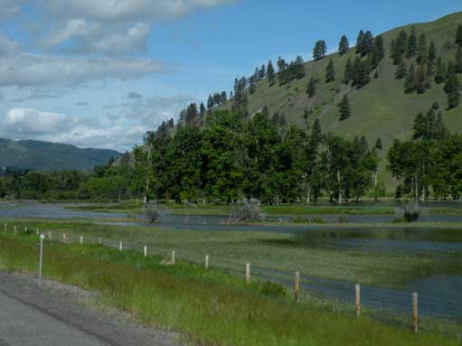
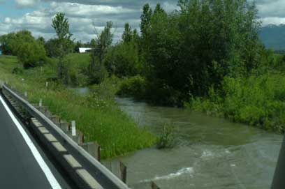
Water anyone? The Clark Fork River, south/east of Missoula, is out of its bed. We’re on I90 and this water is very close. Constant rains, which are beginning to ease off, have caused the flooding. It has been too cool for any meaningful snow melt. That comes next.
|
|
|
|
|
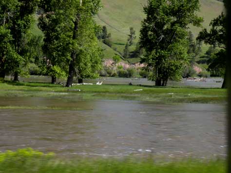
If you look closely, you’ll see the two geese out on the island. The Clark Fork would normally only be flowing on the back side of the trees. Having a strong current on both sides means those geese are pretty safe from predators. And, if there’s not enough food, they can fly where ever they wish.
|
|
|
|
|
|
|
|
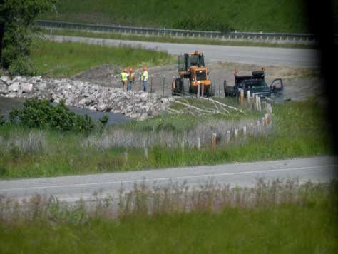
Rip-rap. It is being placed along a curve in the River where the bank is eroding, endangering the I90. Road crews are out everywhere either checking for road damage or fixing damage to the roads or trying to prevent road washouts.
|
|
|
|
|
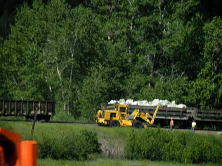
The rail lines have had their own troubles with all the water. Here, freight cars are hauling rip-rap to pour down a steep-sided, raised track immediately next to the Clark Fork. This is a very short distance from where I took the pictures above.
|
|
|
|
|
|
|
|
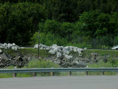
The light colored rock has been dumped from the train cars. It awaits heavy equipment to push it down to the grayish rock just beyond the highway fence. Doesn’t look possible, but that big River is flowing between the rocks & the freeway fence.
|
|
|
|
|
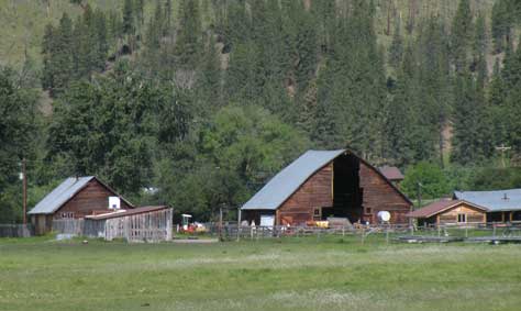
Just to remind those who read this: I am taking pictures from the windows of the motorhome as Gary careens down the freeway going about 62 MPH. So sometimes I get a picture with more than I bargained for. I thought I was just taking a picture of a standard barn in a pretty setting. Little did I know the result would be a barn that seems to defy gravity. Don’t ask. I have no idea how that barn stays upright.
|
|
|
|
|
|
|
|
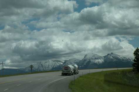
North of Missoula, on Hwy. 93, I took this as we ascended a rather steep mountain. Just took my breath away! That is one heck of a lot of snow on those mountain tops this late in the year. Usually by now, it is just remnants. As a lot of the U.S. really heats up, we are looking at temps in the 60’s today.
|
|
|
|
|
Now we are descending that mountain mentioned above. Once again, I am so overwhelmed by the beauty of the area. I’ve seen this before, several times. It always takes my breath away. Such majesty! This is one reason we always want to be in this part of Montana. For those wishing to know these things: These are the Mission Mountains. I know ‘cause I read the sign.
|
|
|
|
|
|
|
|
We are about halfway between Missoula & Kalispell. As the water runs under the highway, it has reached a level that just touches the underside of the tubes that guide it under the roadway.
|
|
|
|
|
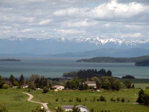
Flathead Lake, seen here at its southern end, looking north. The Lake would have flooded if not for Kerr Dam. The dam was opened as much as could be & averted serious flooding threats. See story below.
|
|
|
|
|
|
Kerr Dam is a three-unit hydroelectric plant on the Flathead River about five miles southwest of Polson, located at the southern end of the lake, and the natural outlet of Flathead Lake. The units have a total generating capacity of 194 megawatts. (One megawatt can take care of the average energy needs of 750 households.)
The dam, which began operation in 1938, is 541 feet long and 205 feet high. Its installation raised the level of Flathead Lake by 10 feet over the natural lake outlet. Kerr Dam uses the water stored in its reservoir to generate electricity.
Flathead Lake, which lies in the Flathead Valley of northwest Montana, is the largest natural freshwater lake west of the Mississippi. The lake is 28 miles long, up to 15 miles wide and more than 300 feet deep. This information is from the Kerr Dam website.
The lake has several large islands. The largest of them is a wildlife refuge & has a small herd of wild horses inhabiting it along with bighorn sheep, coyotes, etc. Some islands are privately owned with homes on them. Water sports of all types are enjoyed here. There are at least 2 private lake tour boats available for the public to buy tickets to enjoy an afternoon tour or evening dinner cruise. With several state parks & marinas for the public + private docks, speed boats pulling skiers, fishermen searching for just the right spot to catch that big one, parasails, jet skis, people just opening up the throttle & seeing how much wake they can create, canoes, kayaks & swimmers enjoy this water wonderland. Several small towns surround the lake, as do many homes. Vacation homes, year-round homes & vacation rentals are very popular. It’s quite a place!
|
|
|
|
|
|
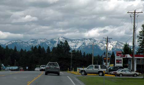
Follow this road, Hwy. 35, to Spruce Pines On The River Campground. Busy road, peaceful campground. So excited! Cannot wait to arrive.
|
|
|
|
|
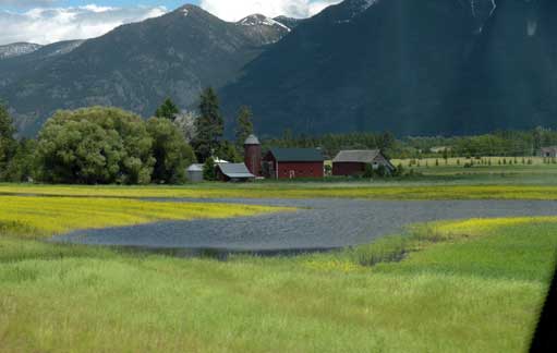
This farm’s crops are struggling to grow in spite of the flooding seen in the lower center of the picture. The excess water is causing some fungus problems for wheat farmers & is costing them a fortune in remedies they have to apply to save their crops.
|
|
|
|
|
|
|
|
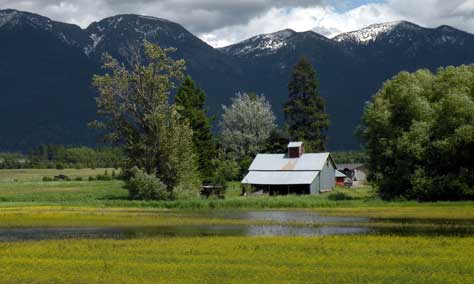
More of the flood waters standing in the fields of this farmer. It is very picturesque, but, oh, these poor farmers.
|
|
|
|
|
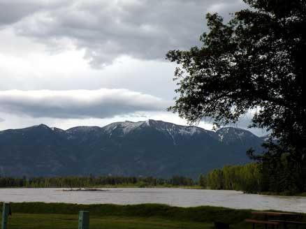
Home at last!! For the next month anyway. Wow, it is so pretty here. Quiet & peaceful. Yum! This is the view from our windshield. And for right now, our view is not blocked by campers in the row in front of us.
|
|
|
|
|
|
|
|
Our view upstream from the couch window. Something to look at all the time.
|
|
|
|
|
(c) Lanesroadhouse is a copyrighted web site. No reproduction of copy or pictures without express written consent.
|
|